In my previous employment, I designed and implemented a system which is approved by the UK Hydrographic Office for accessing charts provided by the Admiralty Vector Chart Service

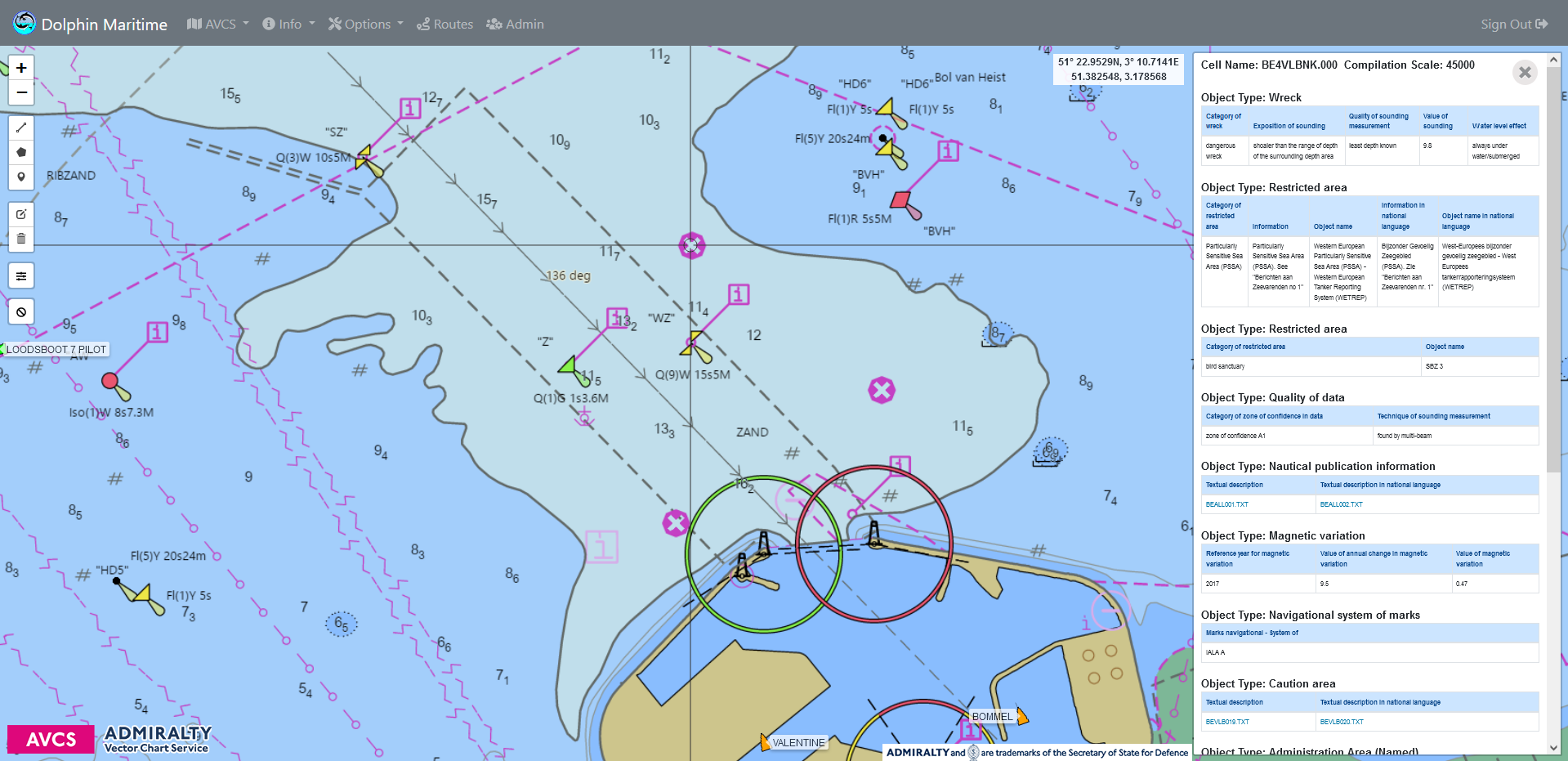

As well as fully implementing the Admiralty Vector Chart features, the system adds the following extras.
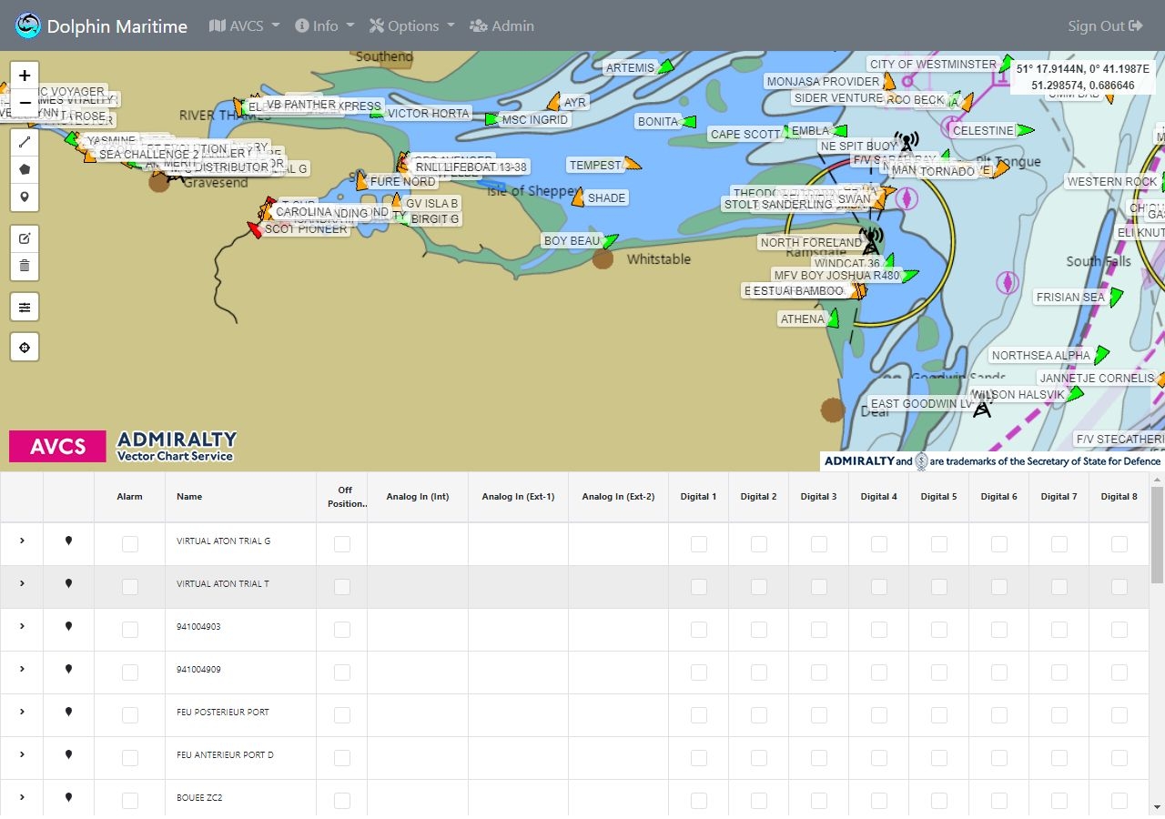
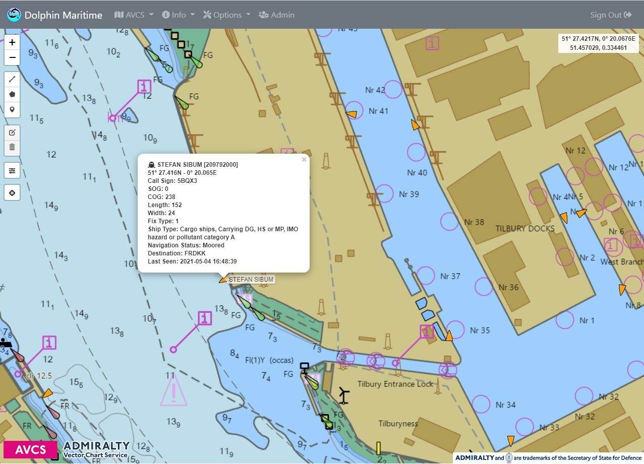
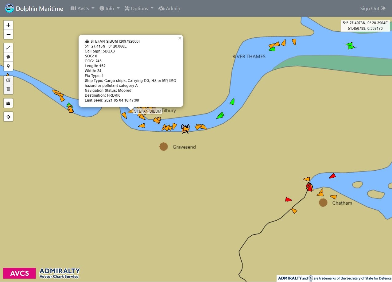
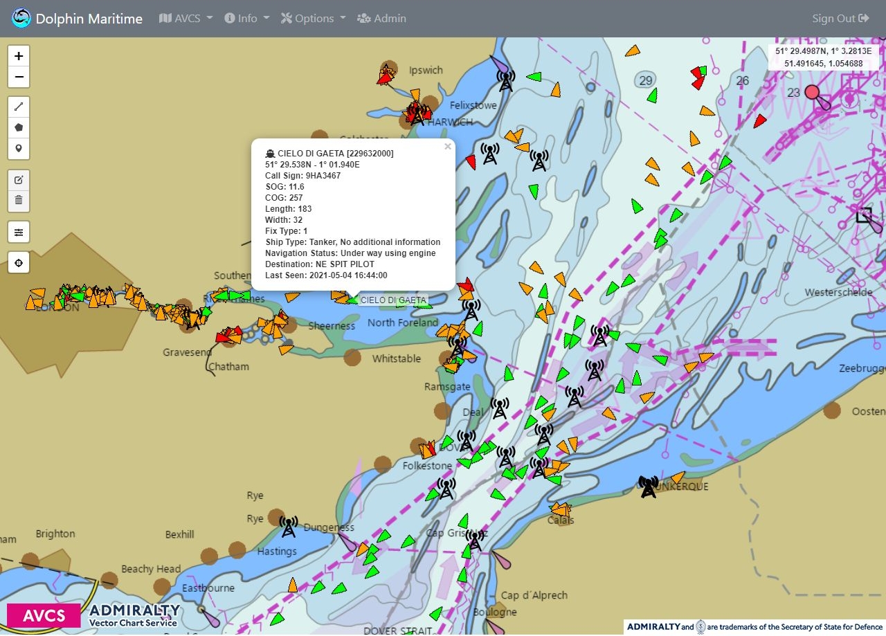
Automatic identification system (AIS) decoding of received signals from ships and other vessels, with display of and logging of details.
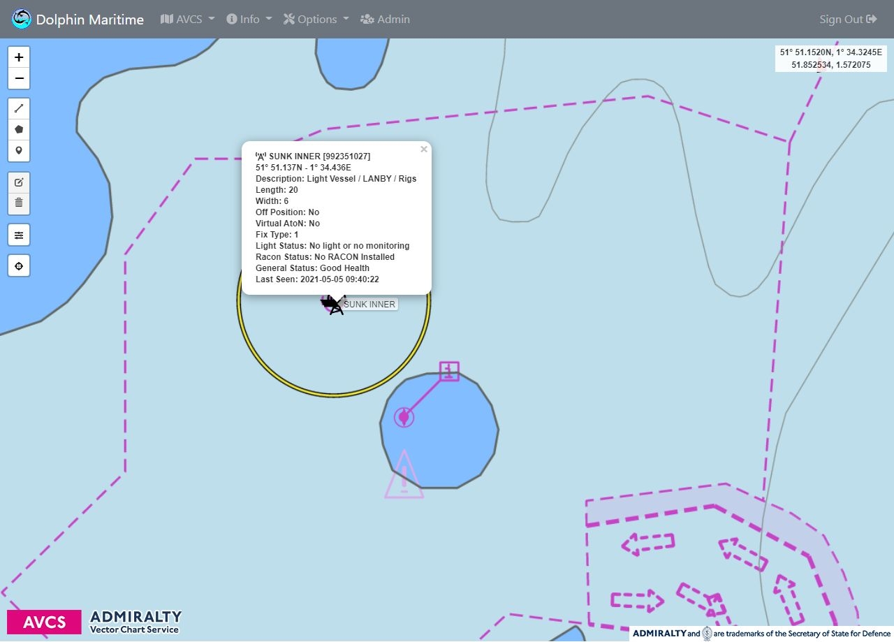
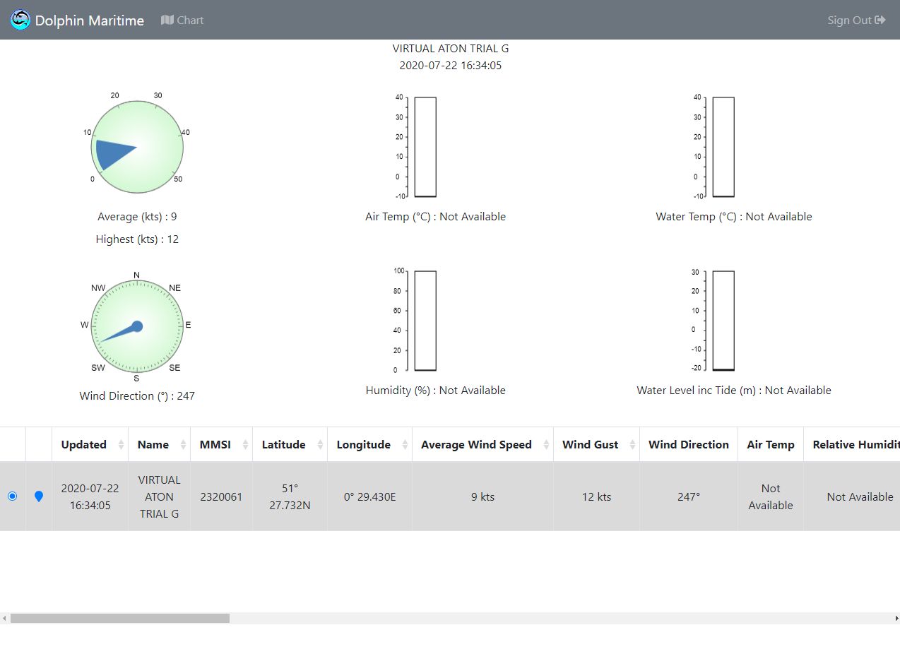
Built-in AIS signal decoding of received signals from AIS aids to navigation (AtoN’s), light vessels, buoys and virtual targets, along with the display of transmitted data including status, weather and tidal information.
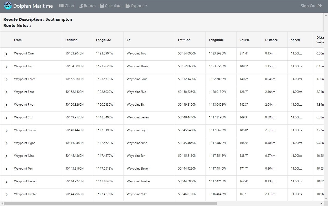
Storage of multiple sets of routes and waypoints, for easy retrieval and editing with drag and drop as well as direct of coordinates.
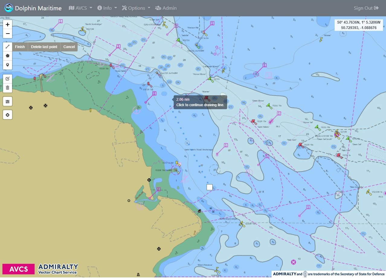
Plotting of routes and waypoints, for easy voyage planning and monitoring.
Calculation of routes at chosen speeds for precise navigation.
Importing and exporting of routes and waypoints from and to RTZ (Route Plan Exchange) files.
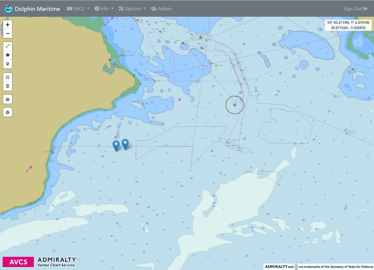
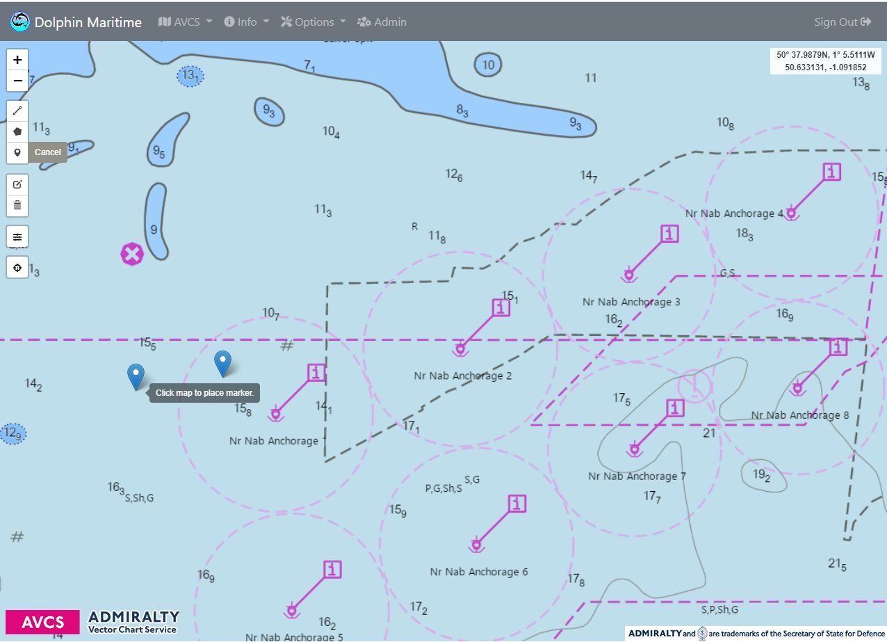
Drag and drop markers for highlighting anchor positions and other positions of interest, etc.
Importing display and editing of various formats such as GeoJson, KML, etc.
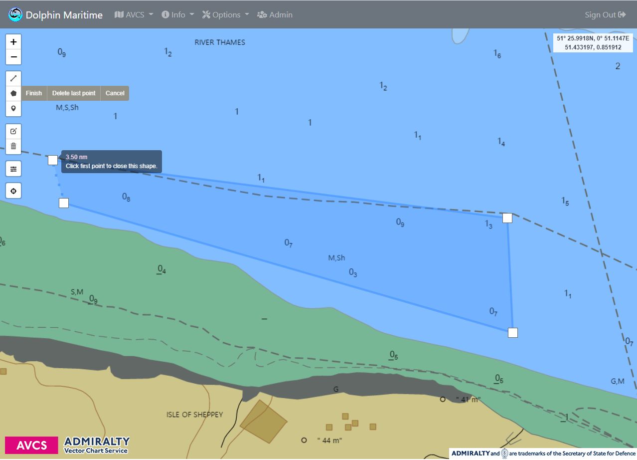
Creation and editing of polygons for marking danger zones and other zones or areas of interest, etc.